Establishing an accurate and reliable datum and subsequently taking precise levels on site are fundamental aspects of various construction and surveying projects. A datum acts as a fixed reference point from which all vertical measurements on a site are determined.
Establishing a clear and stable datum ensures consistency and accuracy throughout the project lifecycle, from excavation and foundation laying to building construction and finishing works. Precise levelling involves measuring the elevation of points relative to the established datum, allowing for accurate setting out of structures, drainage systems, and other critical elements. This article outlines the key principles and procedures involved in establishing datum and taking levels on construction sites.

Establishment of a Datum
For accuracy in construction, it is essential that all levels in a building are taken from a fixed point called a datum. This point must be established at the onset of the construction work, during the setting out operation. Where feasible, the datum should be related to an ordnance benchmark. This symbol resembles an arrow with a horizontal mark above the arrow as shown in Figure 1.

The centreline of the horizontal is the precise elevation denoted on an Ordnance Survey map. Ordnance benchmarks are typically located incised or embedded within the sides of walls and buildings. Where there are no benchmarks on or near the site, an appropriate reference point must be designated. A project datum or interim control point could be a concrete monument or a permanent concrete base established on the project site.
Therefore, several methods can be employed to establish a datum, depending on the project requirements and local regulations. Common approaches include:
- Transferring from Ordnance Benchmarks (OBMs): Utilizing existing, fixed reference points established by national survey agencies.
- Direct Connection to a Stable Structure: Referencing a permanent and stable structure on site, such as a building foundation or an established control point.
- Arbitrary Datum: Setting a convenient point on site as the reference, clearly documented and protected throughout the project. Sometimes, the connecting roadway to the site is conveniently taken as the reference point.
The datum on a site, representing the reference height, can be arbitrarily assigned an elevation of 0.00 meters, regardless of its physical location with respect to ground level. This offers flexibility in assigning positive elevations to subsequent levels throughout the building. For example, if the datum is set at 0.00 m, the top of the ground floor level could be designated as +0.6 m (meaning that the ground floor level is 600 mm above the datum), followed by the first floor at +3.6 m, and so on, as the structure progresses upwards.
Conversely, any feature located below ground will have a negative elevation relative to the datum, indicated by a preceding minus sign (e.g., -1.2 m for the depth of foundation). However, it is possible to arrange the levels such that a positive value is maintained throughout the project.
It is important to note that these elevations typically refer to finished floor levels (FFL), signifying the final height of the floor surface. However, other points of interest can be designated using this system as well, such as finished structural levels (FSL).
The key considerations in the selection and adoption of a datum on site are;
- Stability: The chosen datum point must be stable and unlikely to be disturbed by construction activities.
- Accessibility: The point should be readily accessible for repeated measurements and transfer of levels.
- Clarity: The datum definition and location must be clearly communicated and documented for all stakeholders.
Taking Levels
Levelling is a fundamental surveying technique employed to ascertain the height differential between two points. This process serves two primary purposes:
- Elevation determination: Precisely establishing the elevation of a point relative to a fixed reference plane known as a datum.
- Target elevation achievement: Positioning a point at a predetermined elevation with reference to the same datum.
Precise levelling involves measuring the elevation of points relative to the established datum, allowing for accurate setting out of structures, drainage systems, and other critical elements.
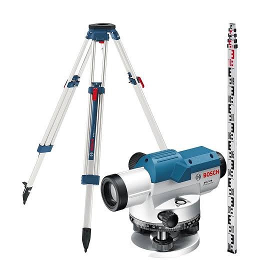
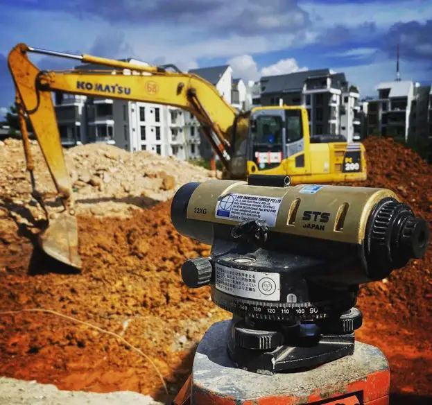
The primary instruments used for levelling operations are an engineer’s level (dumpy level) and a levelling staff. The engineer’s level is essentially a telescope equipped with cross-hairs for precise alignment, mounted on a tripod with a horizontal axis plate. The levelling staff, typically constructed with extendable or folding sections, typically measures 4 meters long. “E” pattern graduations, marked at 10 mm intervals, are commonly used, although some staffs may feature 5 mm graduations. To ensure accuracy, readings are estimated to the nearest millimetre.


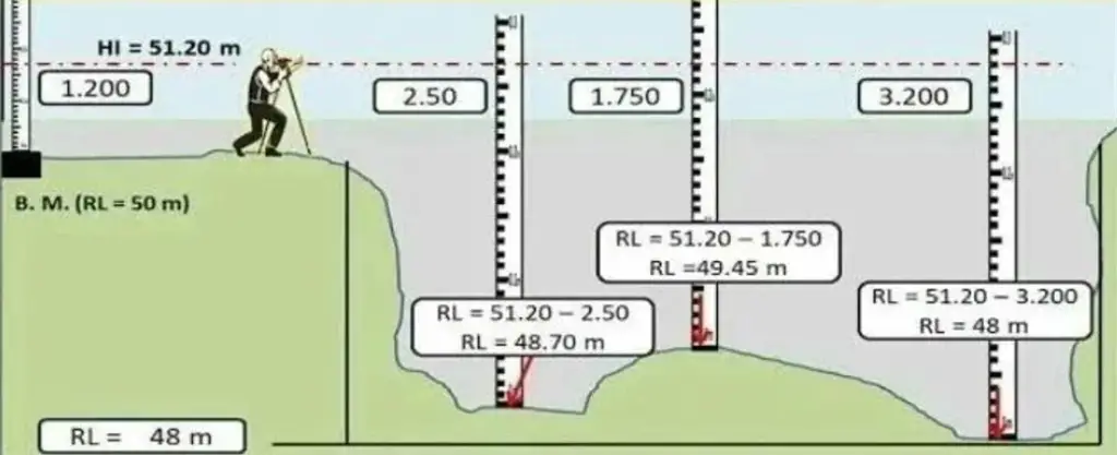
Levelling procedures begin by setting up the instrument on stable ground and taking a sight to a designated benchmark. Next, staff stations are established at predetermined intervals, often following a 10-meter grid pattern. The engineer then takes instrument readings for each staff station. By combining these differential readings with calculations based on the site plan area, the volume of material required for excavation or cut-and-fill operations to level the site can be accurately determined.


Rise and fall method:
Staff reading at A = 3.2 m
Staff reading at B = 0.95 m
Ground level at A = 100 m above ordnance datum (AOD)
Level at B = 100 m + rise (− fall if declining)
Level at B = 100 m + (3.200 − 0.950) = 102.250 m.

Alternative height of collimation (HC) method:
HC at A = Reduced level (RL) + staff reading
= 100 m + 3.200 = 103.200 (AOD)
Level at B = HC at A − staff reading at B
= 103.200 − 0.950 = 102.250 m
Conclusion
Establishing a reliable datum and taking precise levels are essential aspects of ensuring project quality and accuracy. By following best practices and adhering to professional standards, surveyors and construction professionals can ensure consistent and dependable results throughout the project lifecycle.


