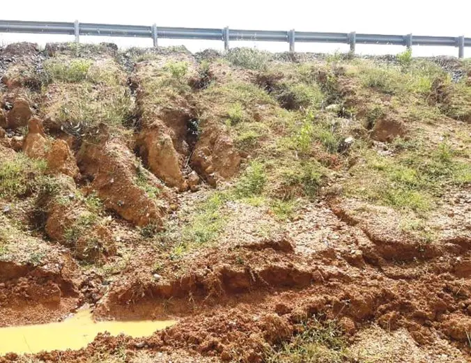
Soil erosion, defined as the detachment and transport of soil particles by water, wind, or other external forces, presents a significant challenge to agricultural productivity, livability, transportation, and environmental health. Surface erosion of cropland diminishes its potential yield, while the eroded sediments degrade the quality of downstream waterways such as streams, lakes, and reservoirs. Similarly, on roadside embankments, erosion creates rills and gullies, exacerbating surface runoff and eventually leading to slope instability and failure.
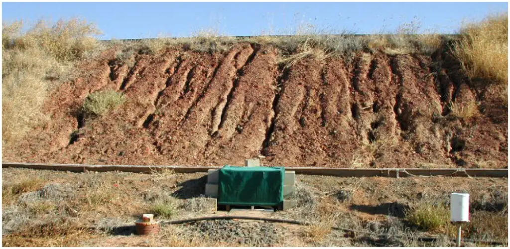
The United States Department of Agriculture (USDA) developed the Universal Soil Loss Equation (USLE) in response to this pressing issue. This widely adopted model predicts the average annual rate of sheet and rill erosion on agricultural land, taking into account key factors such as rainfall patterns, soil characteristics, topographical features, crop selection, and agricultural practices. Mathematically expressed as:
A = R × K × (LS) × C × P
where:
A = average annual soil loss; it is conventionally expressed in tons/ac/yr,
R = rainfall and runoff factor; it depends on the rainfall intensity and duration,
K = soil erodibility factor; it represents a soil’s ability to resist erosion and is determined by the soil texture, soil structure, organic matter content, and soil permeability,
L = slope length,
S = steepness factor,
C = cover and management factor; it is the ratio of soil loss in an area with specified cover and management to the corresponding soil loss in a clean-tilled and continuously fallow condition. For bare ground, C = 1.0,
P = support practice factor; it is the ratio of soil loss with a support practice such as contouring, strip-cropping, or implementing terraces compared to up-and-down-the-slope cultivation. For construction sites such as roadside embankment, P is not used in the equation.
In the year 1996, the United States Department of Agriculture (USDA) recognized the limitations of the earlier Universal Soil Loss Equation (USLE) and introduced its refinement, the Revised Universal Soil Loss Equation (RUSLE). While retaining the fundamental structure and factors of the USLE, the RUSLE incorporated significant advancements in the technology used to evaluate each factor and introduced new data sources for improved accuracy.
Key improvements in the RUSLE include:
- Enhanced Rainfall-Runoff Erosivity Factor (R): An expanded database for R provided a more comprehensive representation of rainfall patterns across diverse regions.
- Time-Varying Soil Erodibility Factor (K): Revised K values incorporate the impact of freeze-thaw cycles and soil consolidation for a more dynamic representation of soil susceptibility to erosion.
- Refined Topographic Factor (LS): The LS factor was adjusted to explicitly reflect the ratio of rill to interrill erosion, offering a more precise estimation of topographical influence.
- Continuous Cover-Management Factor (C): Replacing the seasonal approach, C became a continuous function calculated by multiplying four subfactors, accounting for the time-evolving impact of crop cover and residue on erosion control.
- Expanded Support Practices Factor (P): The scope of P was broadened to encompass conditions specific to rangelands, contouring, strip-cropping, and terracing, enabling a more nuanced assessment of management practices in mitigating erosion.
Surface Erosion Control Measures
There are several methods of controlling surface erosion and some of them are the use of ripraps, vegetative cover, composting, and geosynthetics. These methods are discussed in the sections below.
Riprap
The United States Federal Highway Administration (1989) defines riprap as “a flexible lining or facing for channels or banks, consisting of a well-graded mixture of rock, broken concrete, or other suitable material, typically placed by dumping or handwork, to provide erosion protection.” It finds widespread application in protecting and stabilizing embankments, side slopes of waterways (rivers, channels, lakes, etc.), dams, and drainage elements (slope and storm drains).
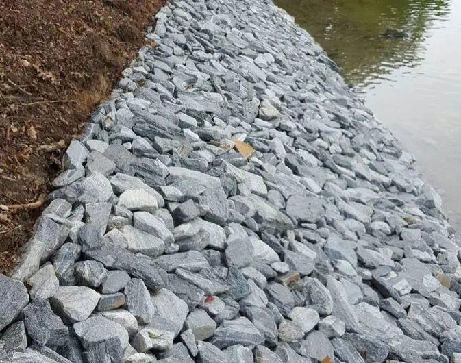
Riprap revetments encompass a variety of options, including:
- Rock Riprap: The most common surface erosion protection method for river and channel banks. Angular, well-graded stones interlock, forming a robust unit that resists erosion due to their weight and combined mass. However, rounded rock on steeper slopes (>2:1) can be unstable, requiring alternative materials like geosynthetic matting.
- Wire-Enclosed Rock: Offers enhanced stability compared to standard rock riprap, particularly on steeper slopes.
- Grouted Rock: Grouting binds the stones together, creating a monolithic structure with superior erosion resistance but reduced flexibility.
- Precast Concrete Block Revetments: Offer efficient placement and consistent quality but may not blend aesthetically with the environment.
- Paved Lining: Provides superior erosion protection but can be costly and alter aquatic habitat.
Designing rock riprap effectively requires careful consideration of various factors, including:
- Rock size
- Rock gradation
- Riprap layer thickness
- Filter design
- Material quality
- Edge treatment
- Construction considerations
Several government agencies offer guidelines for riprap design. Some key design criteria for ripraps are;
- Gradation: Utilize a well-graded mixture of rock sizes for optimal interlocking and stability. Avoid uniform-sized stones.
- Stone Quality: Select durable riprap material resistant to freeze-thaw cycles. Most igneous rocks like granite exhibit suitable durability.
- Riprap Depth: Ensure the riprap layer is at least twice the thickness of the largest stone diameter used.
- Filter Material: Implement a filter material, typically a synthetic fabric or gravel layer, beneath the riprap to prevent underlying soil erosion.
- Riprap Limits: Extend riprap to the maximum expected flow depth or a point suitable for vegetation-based erosion control.
- Curved Flow Channels: In curved sections, extend riprap five times the channel bottom width upstream and downstream of the curve’s beginning and end, covering the entire curve.
- Riprap Size: Select rock size based on the anticipated shear stress from water flow. Sizes typically range from 5 cm to 60 cm in diameter.
By adhering to these recommendations, designers can ensure the effectiveness and longevity of rock riprap installations for various erosion control applications.
Compost
The strategic application of compost, a stable amendment produced by microbial decomposition of organic matter, offers valuable material for mitigating erosion in susceptible areas and accelerating vegetation establishment. Composting not only diverts waste from landfills but also transforms it into useful resources with economic and environmental benefits.
A range of compost types has been successfully employed for surface erosion control on embankments and natural slopes:
- Green material compost: Derived from yard trimmings, clippings, and agricultural byproducts.
- Manure compost: Sourced from dairy or poultry manure.
- Co-compost: Blends biosolids with green materials.
- Wood chip and forestry residual composts: Utilize wood-based waste materials.
- Food scraps and municipal solid waste composts: Offer additional possibilities, though requiring careful assessment.
Due to varying sources and manufacturing processes, compost characteristics can differ significantly in terms of:
- pH
- Soluble salts
- Moisture content
- Organic matter content
- Maturity
- Stability
- Particle size
- Pathogen and physical contaminant presence
Selecting suitable compost for engineering applications necessitates considering specifications set by organizations like the USDA and the USCC. Their “Test Methods for the Examination of Composting and Compost” guide ensures the quality and suitability of the final product. By carefully selecting and applying compost, land management professionals can harness its potential to protect soil, promote vegetation growth, and contribute to sustainable infrastructure solutions.
Vegetation
The utilization of vegetative cover is a prominent method of mitigating soil erosion. Its primary functionalities encompass the protection of the soil surface from the impact of raindrops, the provision of a barrier against the erosive effects of overland flow, and the reduction of the erosive potential of flowing water through attenuation of its velocity. The complex root systems of vegetation contribute to the stabilization of the soil, thereby enhancing its resistance to erosion, fostering infiltration rates, and minimizing runoff.
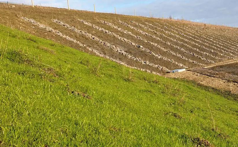
Key attributes associated with vegetative cover include its cost-effectiveness, ease of establishment, and aesthetic value. While frequently employed in conjunction with alternative erosion control techniques (such as compost blankets, geosynthetic covers, and mulches), the design and implementation of vegetative cover necessitate the consideration of several critical factors:
- Soil Characteristics: These encompass attributes such as acidity, moisture retention capacity, drainage, texture, organic matter content, and fertility.
- Site Conditions: Factors like slope gradient and the existing extent of vegetative cover play a pivotal role.
- Climate: Considerations related to temperature, wind patterns, and precipitation levels are essential.
- Species Selection: The selection of appropriate plant species is contingent upon regional climate, planting season, water requirements, soil preparation, weed management, anticipated post-construction land use, and projected maintenance levels (including irrigation and associated costs).
- Establishment Methods: Techniques employed for the successful establishment and growth of vegetation.
- Maintenance Procedures: Practices implemented to ensure the ongoing health and effectiveness of the vegetative cover.
Erosion Control Using Geosynthetics
The utilization of geosynthetics has witnessed a significant rise in popularity in erosion and sediment control, as well as slope stabilization. This proliferation has been fueled by the development of a diverse array of methods and the ongoing emergence of innovative approaches, including degradable rolled erosion control products (RECPs), nondegradable RECPs, and hard armouring techniques.
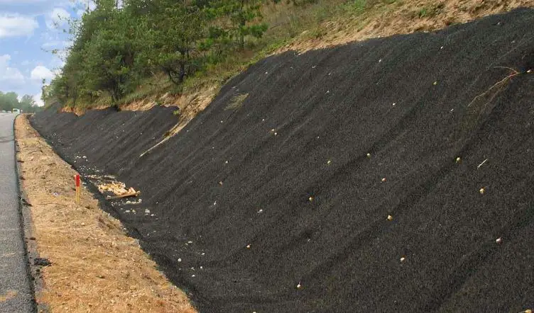
Degradable RECPs offer the potential for enhancing the establishment of vegetation on rehabilitated lakeshores, riverbanks, and newly constructed roadways. Their application is particularly suited to scenarios where vegetation alone is anticipated to provide sufficient long-term protection once the RECP has degraded.
Conversely, nondegradable RECPs offer long-term reinforcement to vegetation, making them ideal for more demanding erosion control scenarios requiring immediate and high-performance protection. These materials achieve their function by permanently reinforcing the vegetative root structure, thereby enhancing the erosion resistance of soil, rock, and other underlying materials.
It is noteworthy that geosynthetic erosion control measures often fulfil multiple functions concurrently. These functionalities encompass surface runoff collection and drainage, filtration, separation, reinforcement, and the facilitation of vegetation establishment and maintenance.
Conclusion
Surface erosion, the detachment and transportation of soil particles by wind or water, poses a significant environmental and economic challenge. Unsustainable land management practices, deforestation, and intense precipitation events exacerbate this natural process, leading to topsoil loss, decreased fertility, and downstream sedimentation.
Fortunately, various control measures can be implemented to minimize erosion’s impact. Rock riprap can be used on slopes and embankments to control surface erosion. Vegetation cover, a cost-effective and aesthetically pleasing approach, protects the soil from raindrop impact and overland flow. Additionally, geosynthetics offer reinforcement and enhanced vegetation establishment, particularly in critical areas. By employing strategies tailored to specific landscapes and climatic conditions, we can effectively mitigate surface erosion and safeguard our valuable soil resources.

